Mohammed Bin Salman Nonprofit City Residential District Landscape Concept Design
Riyadh, since 2019
The design for District 5, one of the districts round the core of the Mohammed Bin Salman Nonprofit City, hinges on a variety of plazas and typical zones that together form public spaces which create a strong identity
Use
Landscape Architecture
Timeframe
since 2019
Client
Mohammed Bin Salman Nonprofit City
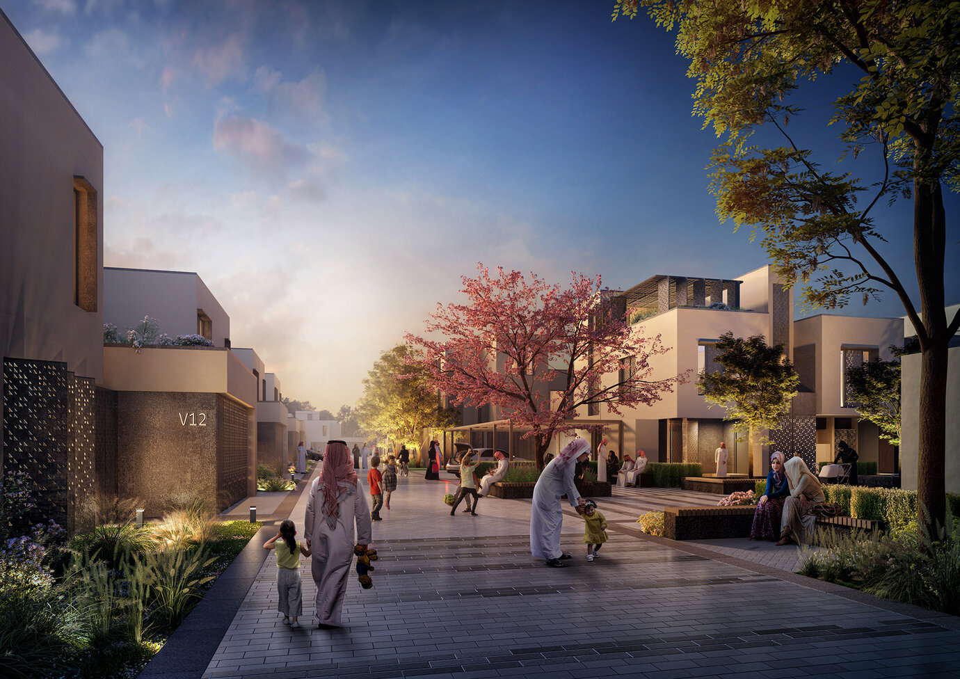
Community Impression showing Vicinity Square
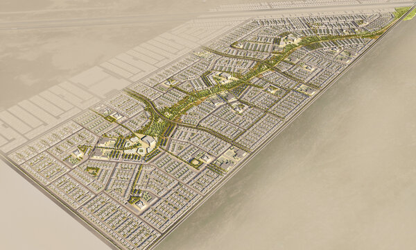
The Residential District 5 is one of the neighbourhood areas surrounding the core of the Riyadh Mohammed Bin Salman Nonprofit City - a 344-hectare big new development for the emerging Saudi generation with focus on innovation, sustainability and creativity. With round 42 hectares, District 5 is complementing the live-work-play environment of the entire Mohammed Bin Salman Nonprofit City. The area includes residential plots with villas and town houses, apartments, a local mosque, a community centre and two kindergartens. The landscape areas are understood as urban or natural open spaces and are defined to establish unique characteristics and varied experiences. The District Park within the Mohammed Bin Salman Nonprofit City is the main green space and serves as a recreational park offering active and passive functions like urban plazas, playgrounds, feature crossings, activity areas and lawn. The Green Corridor is a linear open space with a parklike, but nonetheless arid character. In the interface between the private residences in the east and the residential areas in the west, an extensive landscape buffer is integrated into the concept serving as a transition zone as well as a recreational area for the residents. Furthermore, it plays an important part in the sustainable urban drainage strategy in minimizing inflow to the sewage system, allowing water to percolate into subsoil layers, reducing velocity and incorporating visible stormwater elements like swales. Each neighbourhood shall have its own distinctive identity and is developed around the idea of the Living Street - with the street being a community space rather than a car circulation area. The mobility network is based on flat hierarchies between all users, a strong pedestrian and cycling connectivity and permeability within the neighbourhoods.
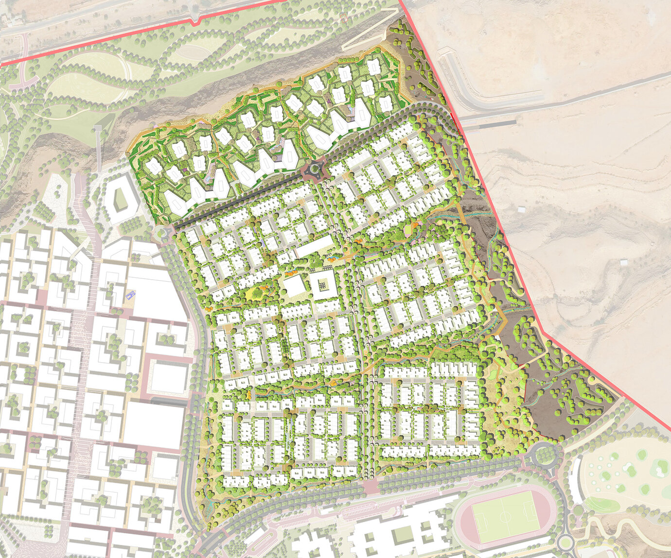
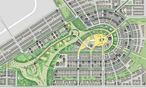
Masterplan District 5
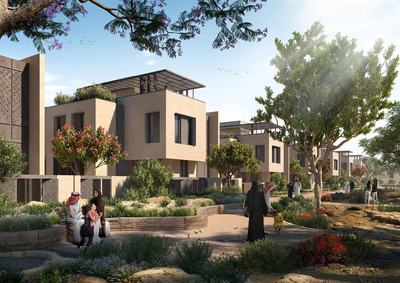
Park Impression showing strolling area and residential buffer
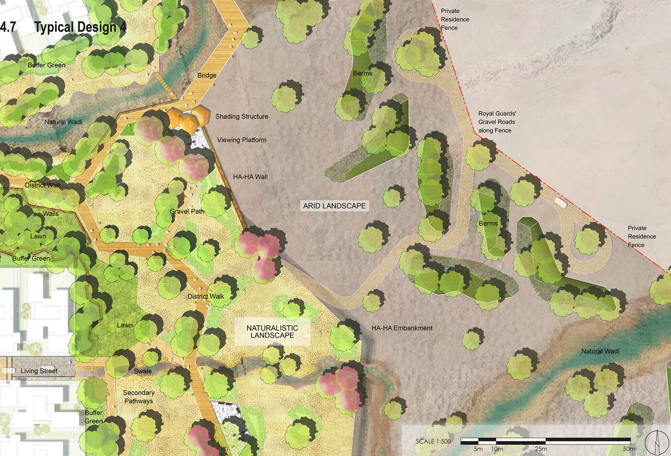
Illustrative zoom-in showing a typical design of the Private Residence Buffer
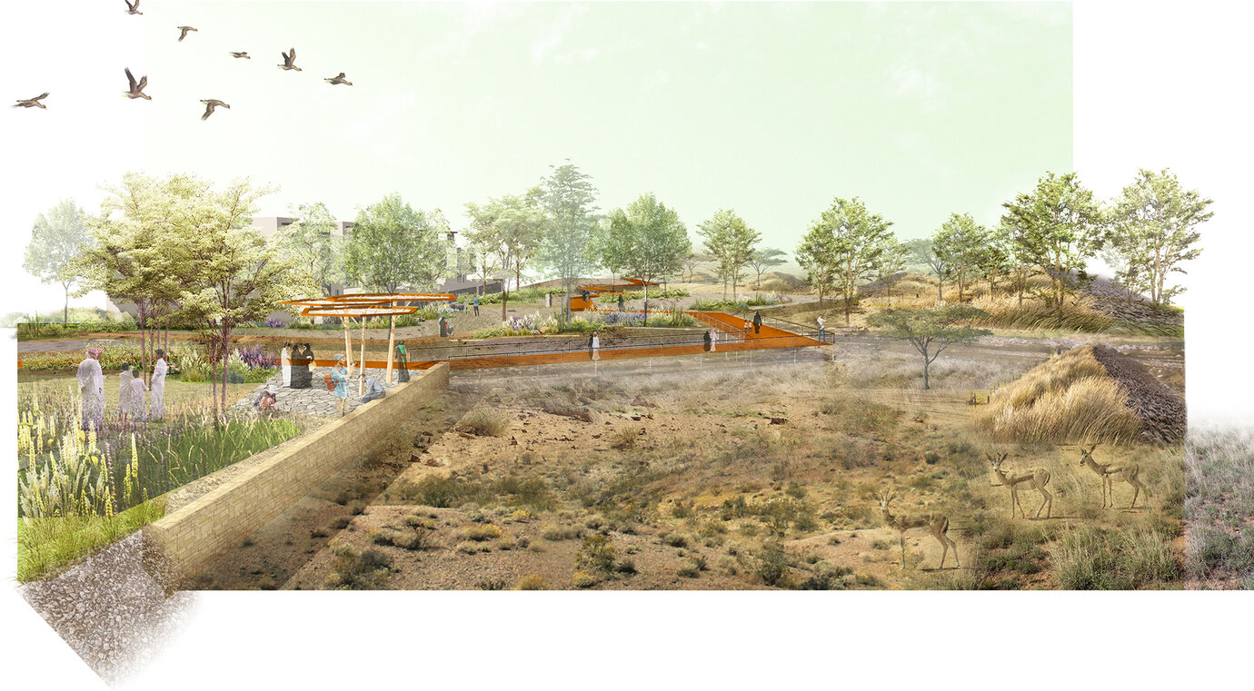
Collage showing Ha-Ha-Edge and extensive landscape design of the Private Residence Buffer
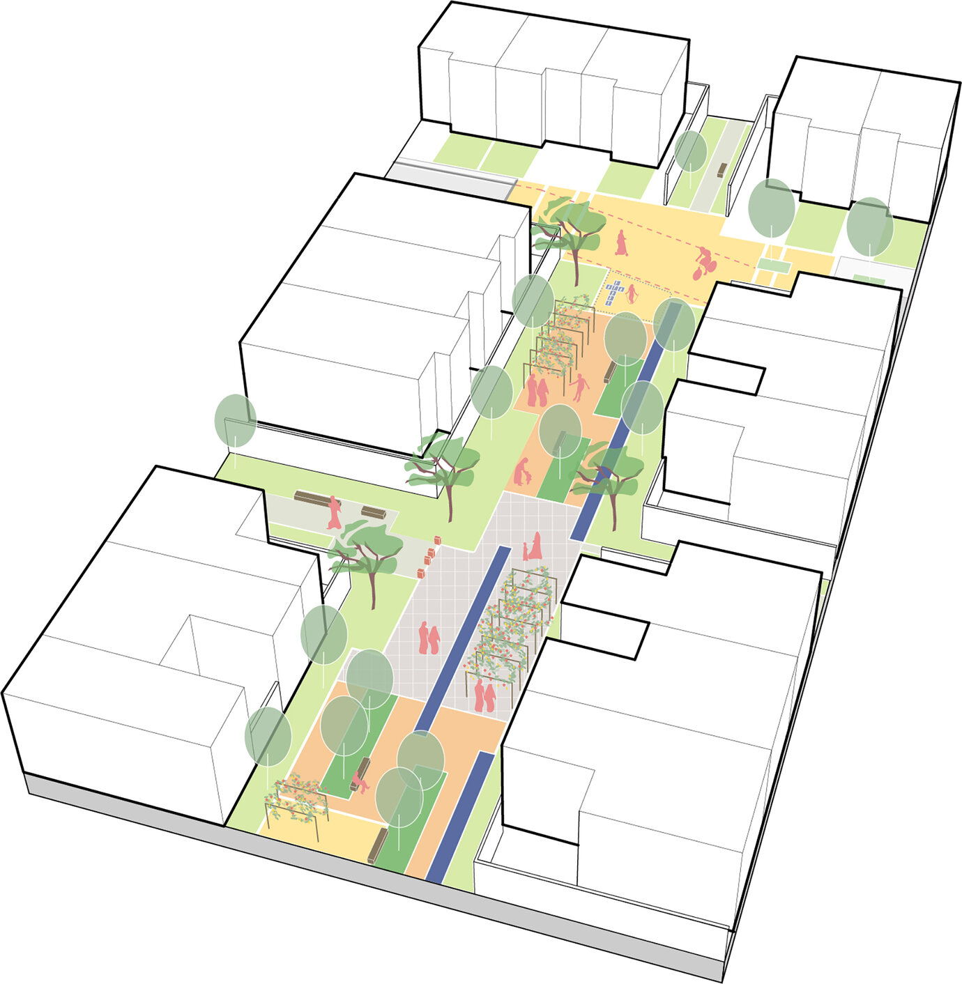
Diagram of a typical Neighborhood Green showing the spatial arrangement
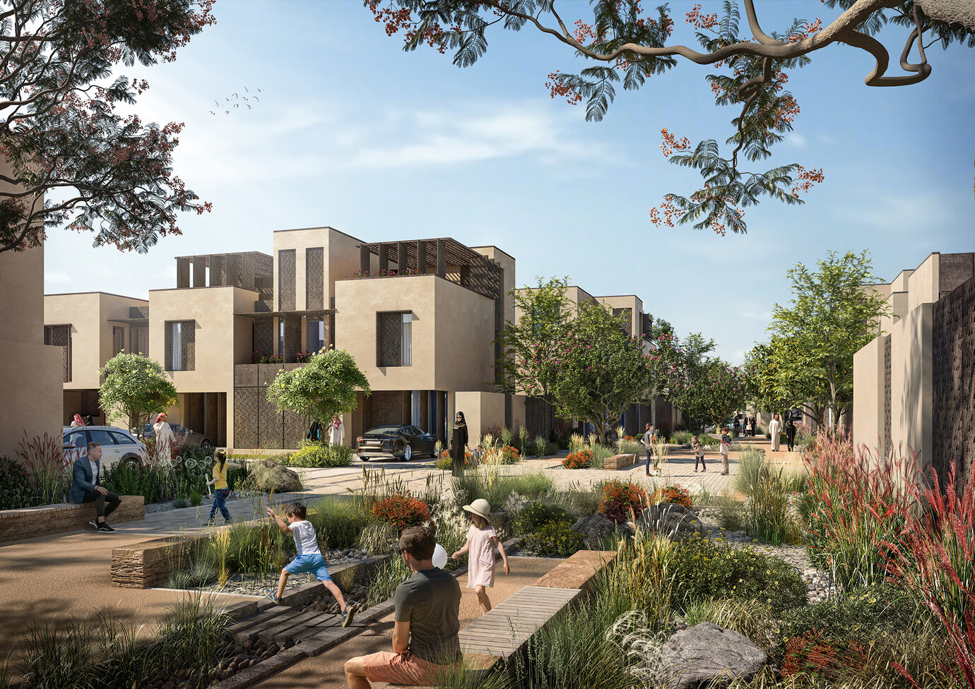
Community Impression showing Neighborhood Green
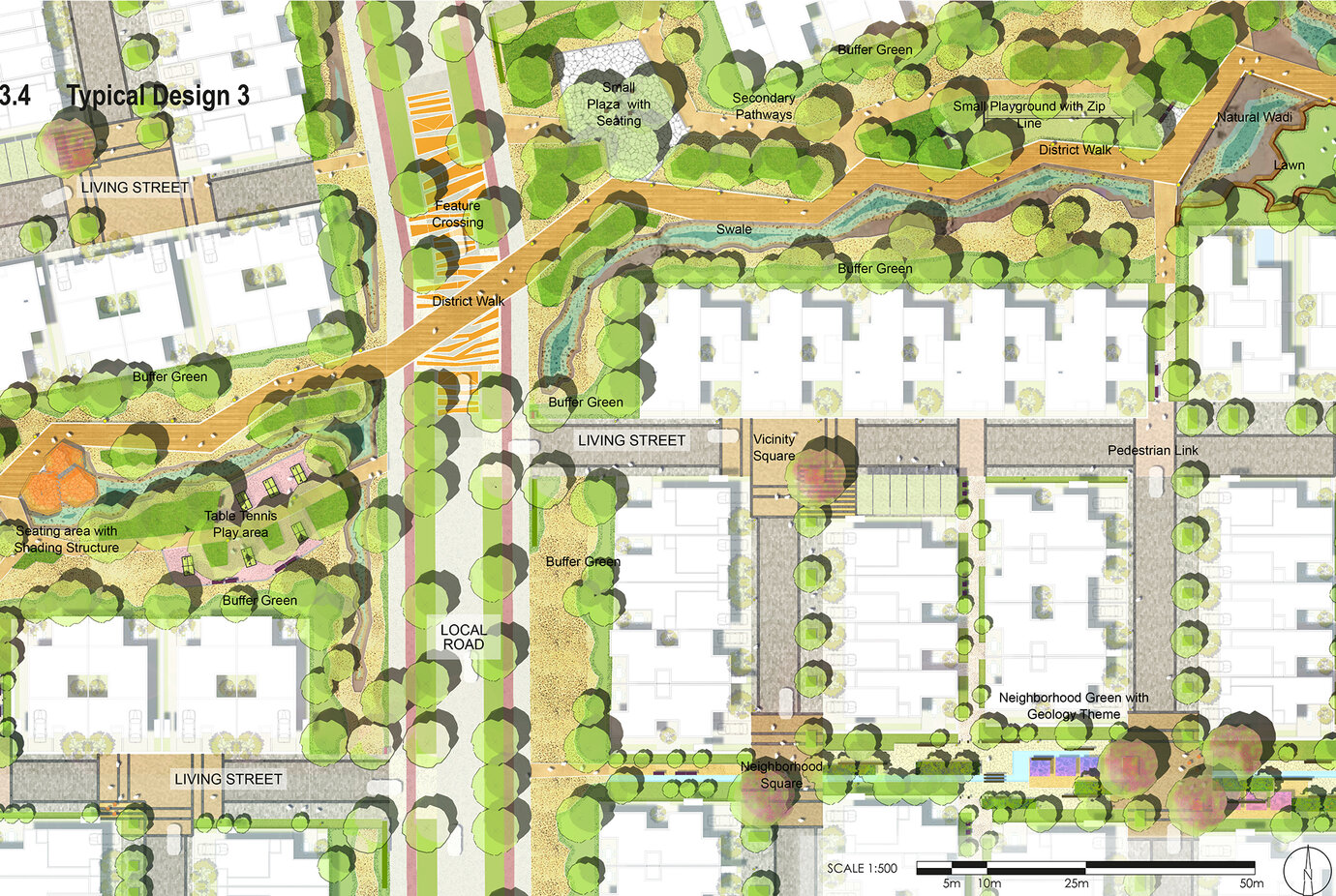
Illustrative zoom-in showing a typical design of the Green Corridor
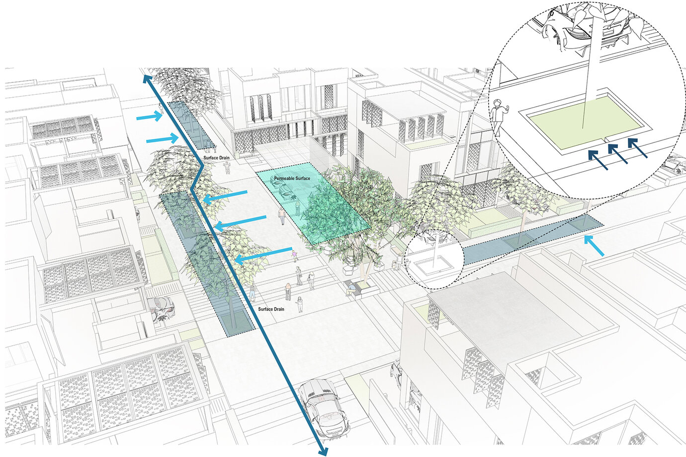
Diagram of a typical neighborhood stormwater management
