Landscape Architecture ROSHN SEDRA Detailed Master Plan
Riyadh, 2019 - 2020
Drafting of a masterplan concept for an area of 2,500 hectares in Riyadh, Saudi Arabia covering urban planning, landscape architecture, transportation, and infrastructure, as well as open space execution planning for the first development phase
Use
Landscape Architecture
Timeframe
2019 - 2020
Client
ROSHN
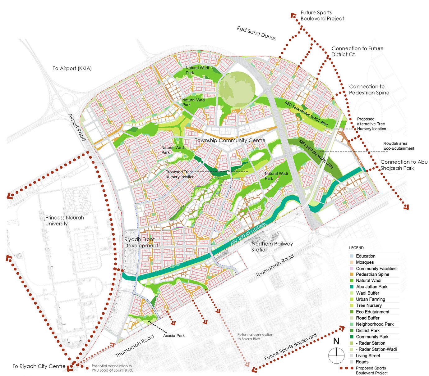
Landscape planning concept with various open-space typologies and connections to superordinated networks.
Based on its successful submission to an international competition launched in 2018 AS+P was commissioned with the design planning for a roughly 2,500-hectare-large area in Riyadh. For the approx. 300 hectare included in the first development phase AS+P worked with local planning partners to also draw up the execution planning. The structure of the urban planning masterplan takes into account the course of the side arms of the Wadi-Sulay system that run through the project area. Wadis are dry riverbeds that carry water after periods of heavy rain. Riyadh is surrounded by two wadis that are eminently important for hydrology and avoiding flood damage in the city region. These unique natural structures are of great value in many regards. Ecological aspects such as the natural blue-green infrastructure to draw off surface water, fertile soils, and a number of native plant species play an important role. Moreover, such components not only convey identity; the contrast between these green lifelines and the otherwise barren desert landscape is also key. As such, it is only logical and a central element of the open space concept to protect, upgrade, and integrate the wadis. After all, they are highly instrumental in improving the quality of life enjoyed by the residents of the new district. The wadis themselves are protected but thanks to sensitive planning interventions also serve recreational purposes and can be accessed via a micro-mobility network. They form the backbone of a diverse and unique open space system that is otherwise made up of natural, near-natural and urban spaces.
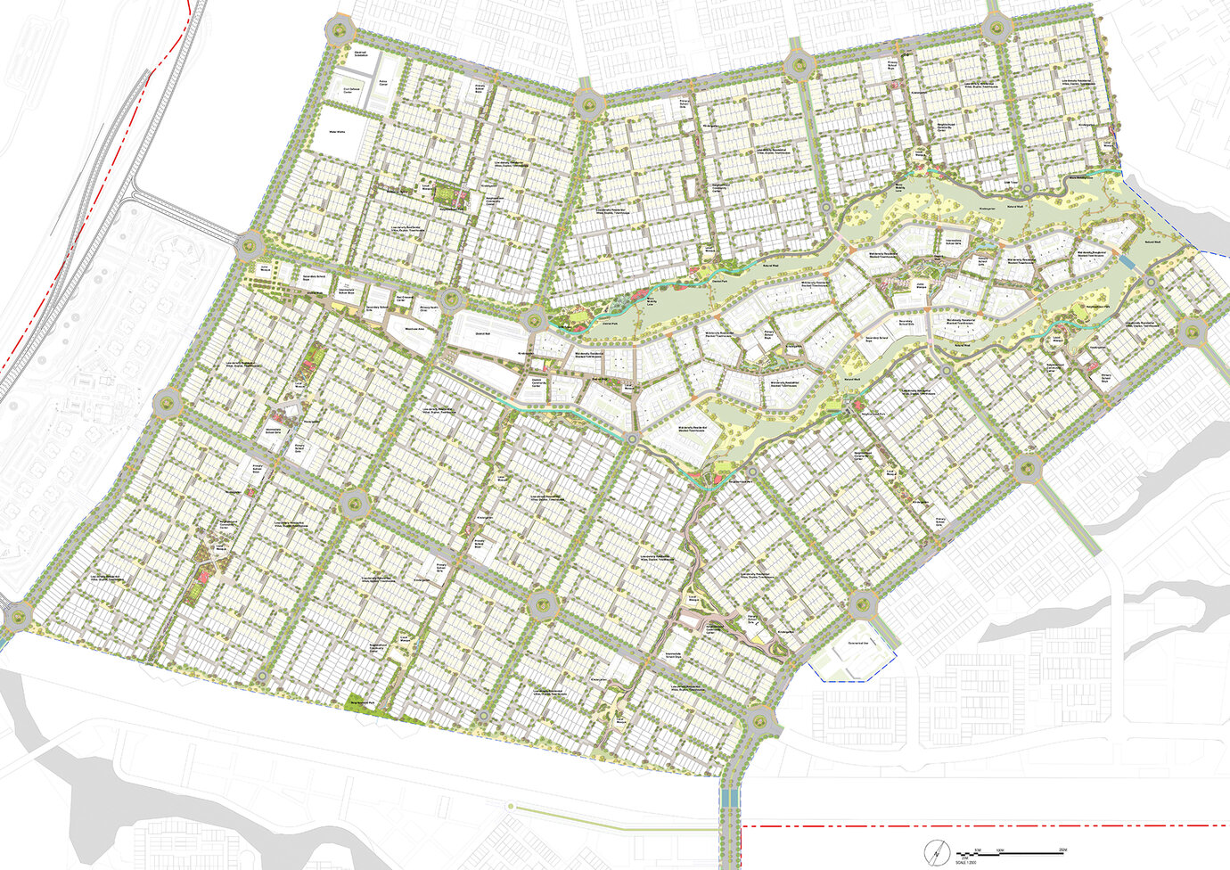
Illustrative overview plan for the open space plannng of Phase 1
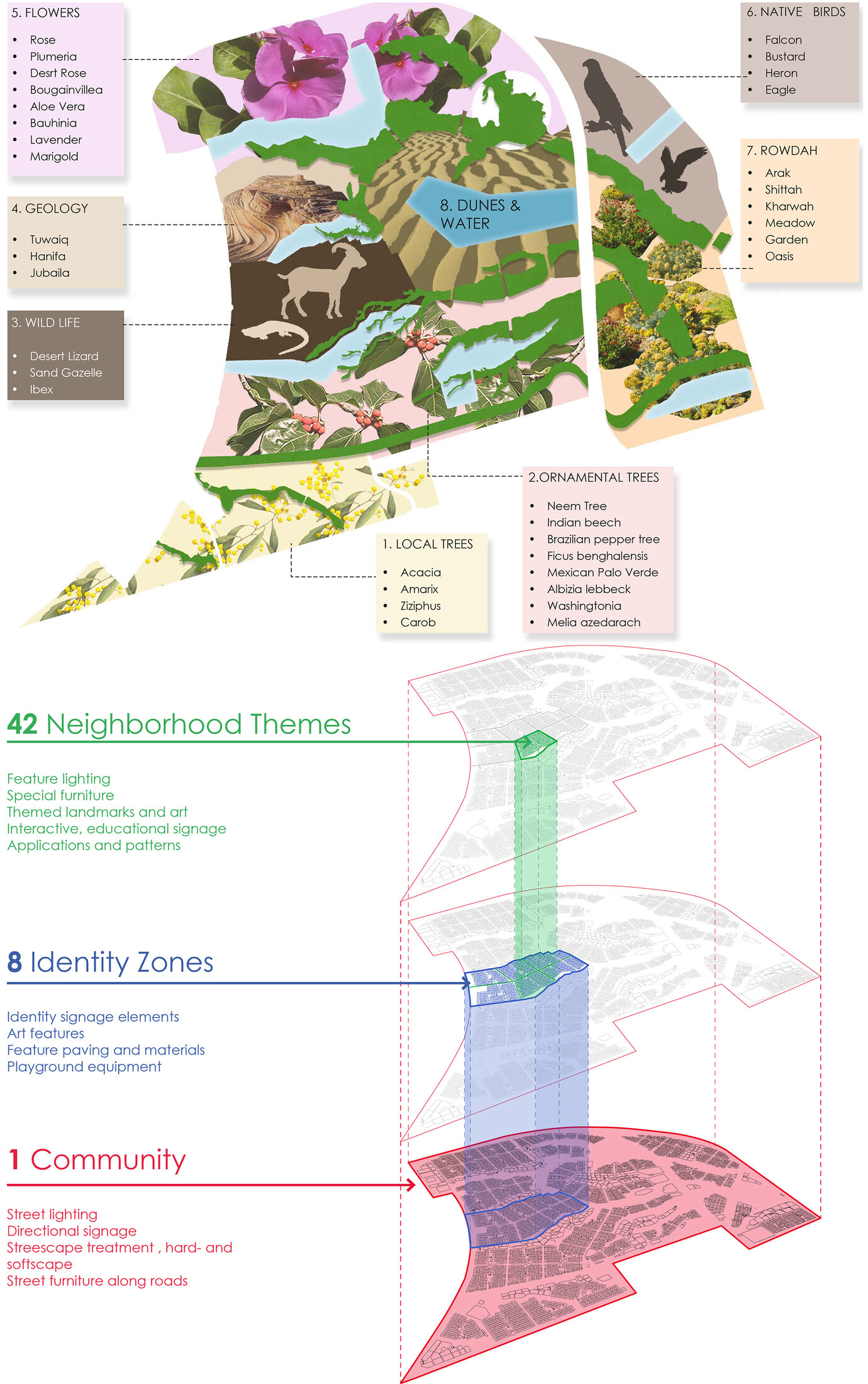
Diagams to illustrate the identity themes for neighbouring quarters.
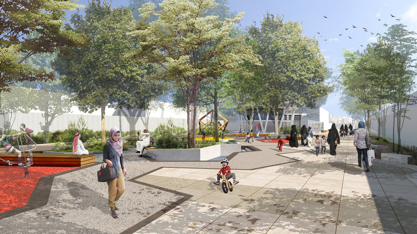
Visualization of a pedestrian spine with playground and kindergarten in the background.
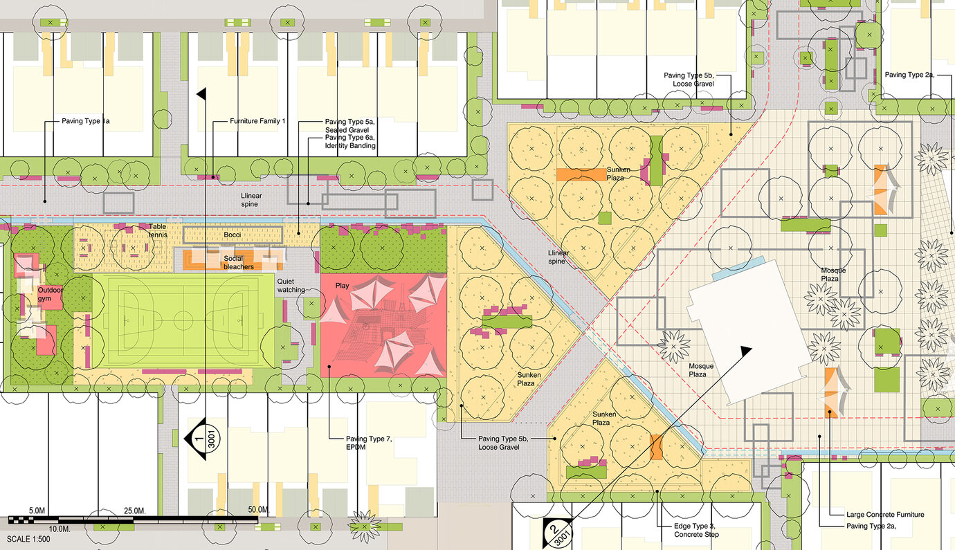
Design planning – section of a pedestrian spine.
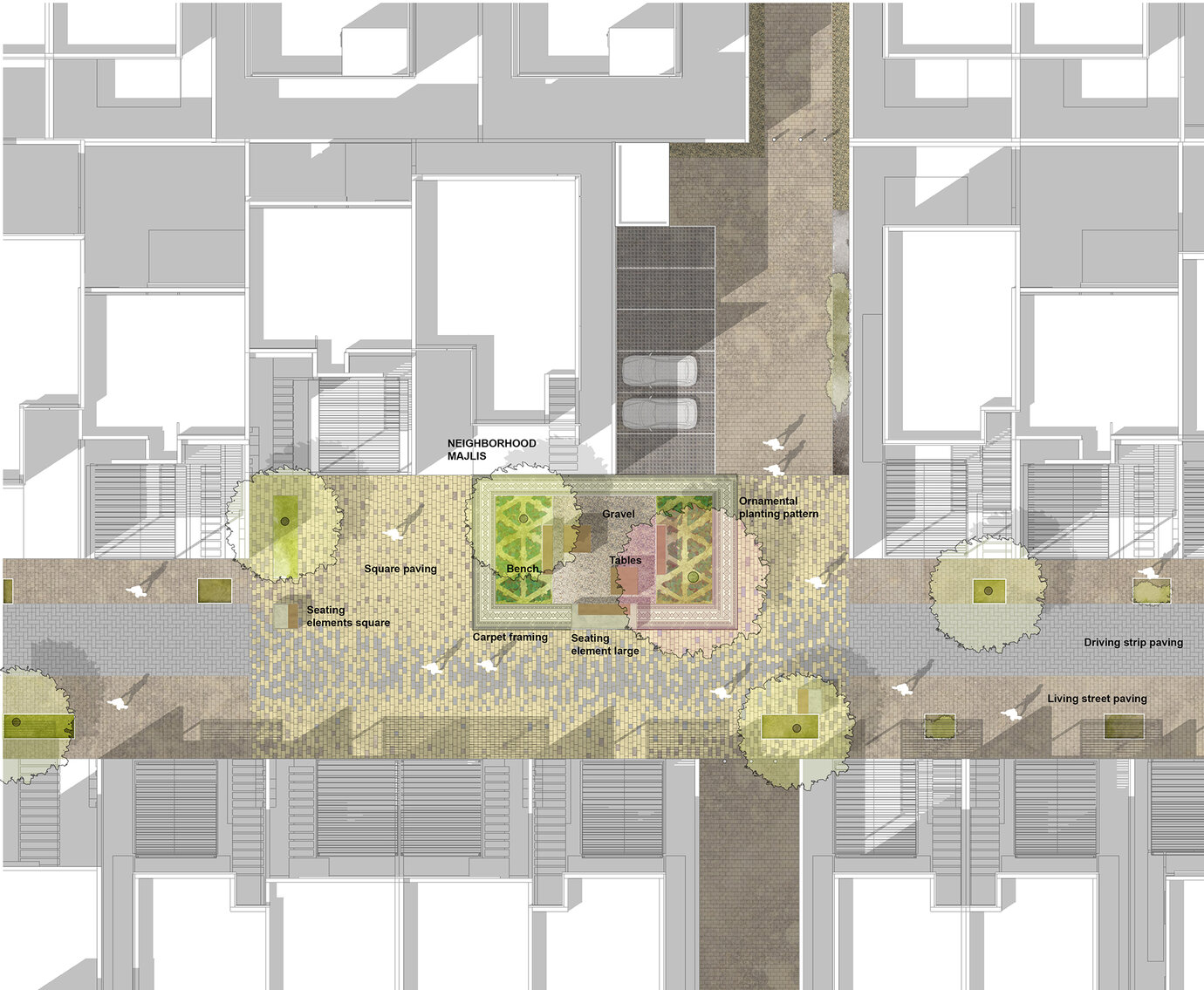
Indicative representation of the living street design – living streets with quality of use for residents.
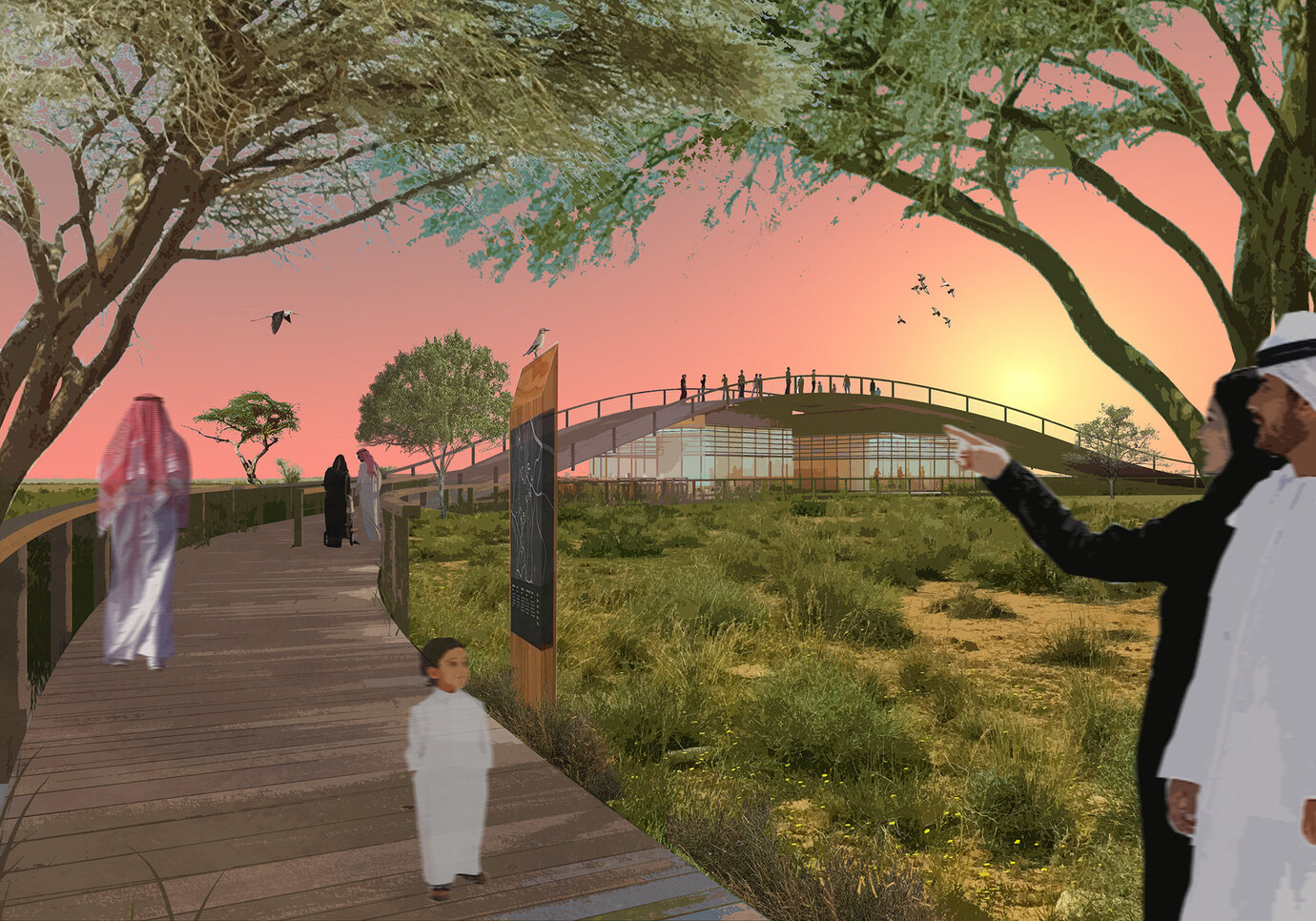
Vizualisation of the proposed Ecotainment Wadi Visitor Centre.
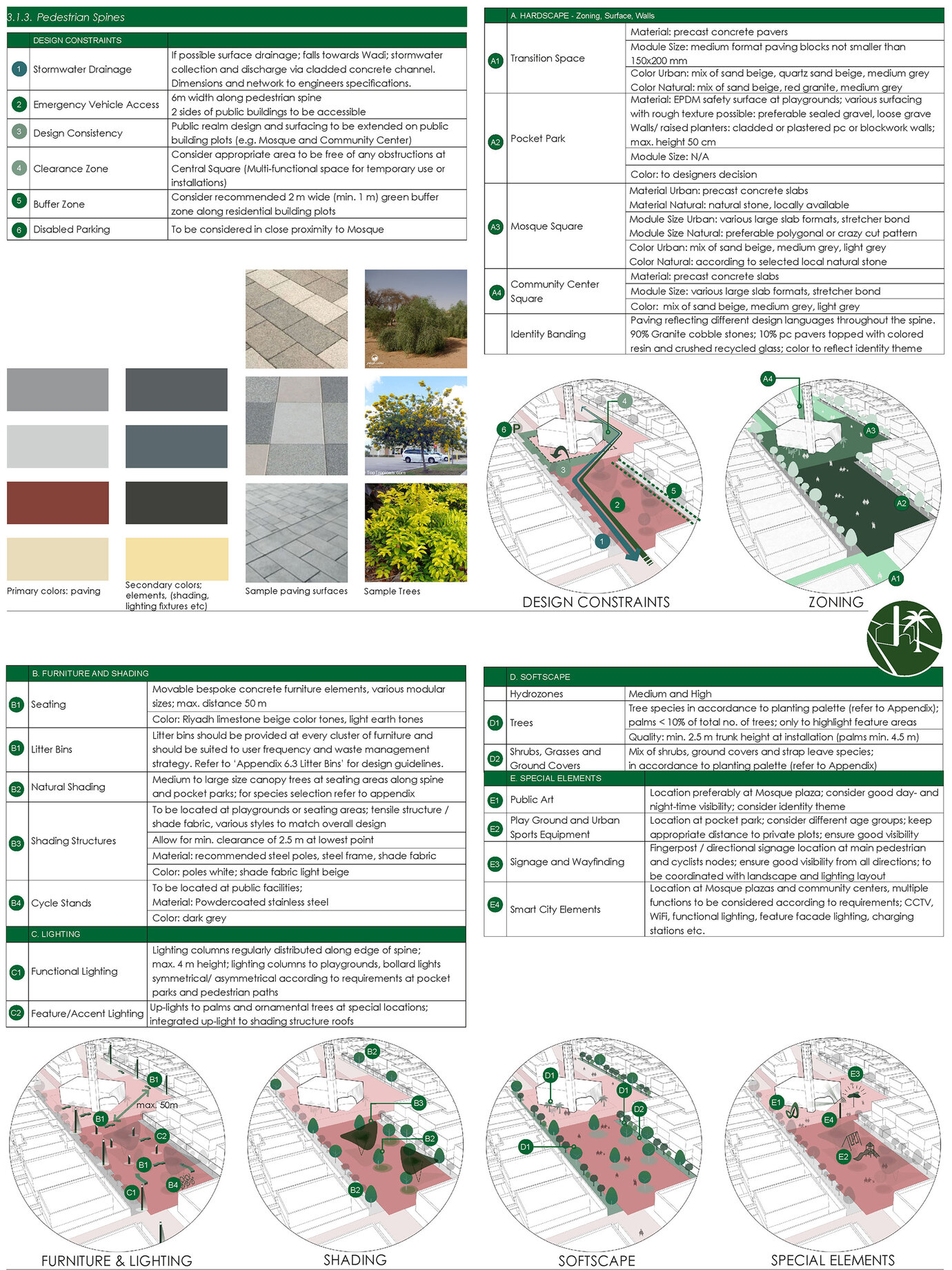
Excerpt from the design guidelines for public space drawn up for the project area.
