Open Space Planning Action Area Plan for Transit Oriented Development (T.O.D.)
Riyadh, 2014
Urban framework planning and open space planning of a Transit Oriented Development for the areas around the new METRO stations in Riyadh city center and planning of a new central bus station
Use
Landscape Architecture
Timeframe
2014
Client
ADA Arriyadh Development Authority
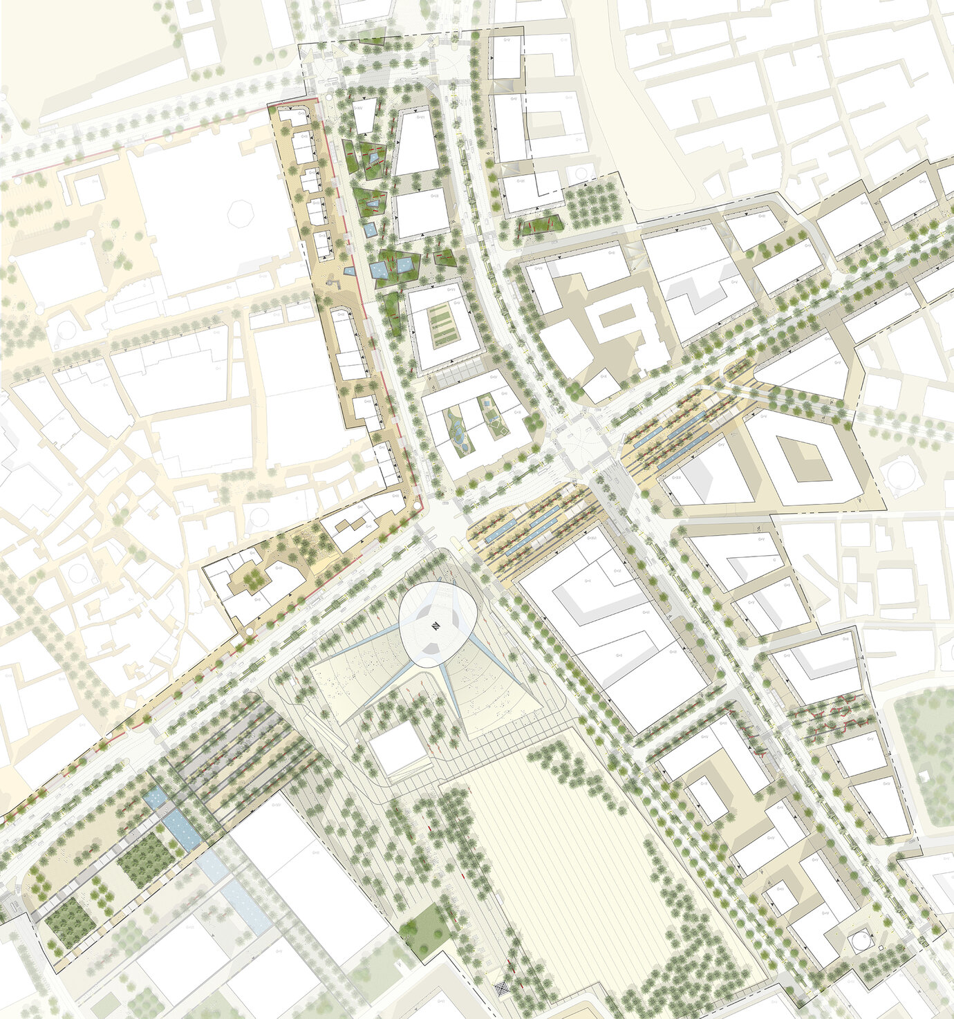
Detail of the hollow around the new METRO station with detailed outline of how the open space has been designed
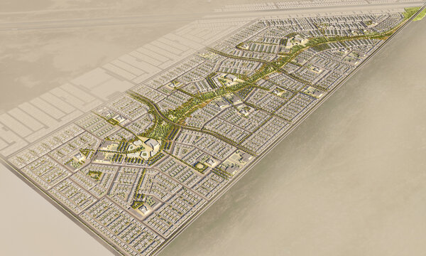
In light of the planned new Public Transport System for the capital of Saudi Arabia, the target of this study has been a progressive conversion of the existing sensitive urban fabric of Riyadh's historic center towards a Metropolitan ‘Transit Oriented Development' within the next 25 years. Without this centennial opportunity it seems unlikely that the renewal of the currently declining Central Area would be undertaken at the foreseen scale and coherence. Well accessed by the important King Fahad Road and Al Batha Road, and three METRO lines with two interchanges and a total of seven stations within an area of 590 hectares, the area qualifies as having the highest connectivity within the city. In contrast to classical TOD developments characterized by high-density mixed uses close to new transit infrastructure, Riyadh's city center has to respond to local history, heritage sites, generous and representative open spaces, existing and new development projects of national importance, and to address broader issues of identity, uniqueness, representation, sociocultural cohesion, and design quality. The vision of a Capital Oasis is interpreted as an integrative public space, where the heart of Riyadh is represented and opened for the public. An envisaged combination of residential, commercial, cultural and leisure uses will guarantee a homogeneous 24 hour vitality and an economic degree of capacity utilization in public transport. A variety of unique architectural addresses and external spaces interlinked by a system of attractive pedestrian and vehicular corridors will make the difference to the fast growing and highly economized predominant urban fabric evident elsewhere in the capital. The study not just included a wider urban planning vision and spatial framework for the area, but also plot specific implementation advice, legal site plans and detailed urban- and landscape design guidance for the public realm.
Illustration of how the open space has been designed around the new boulevard along the Al Batha Road
Photograph of the urban development model with a view of the new boulevard with its oval bus terminal in the foreground
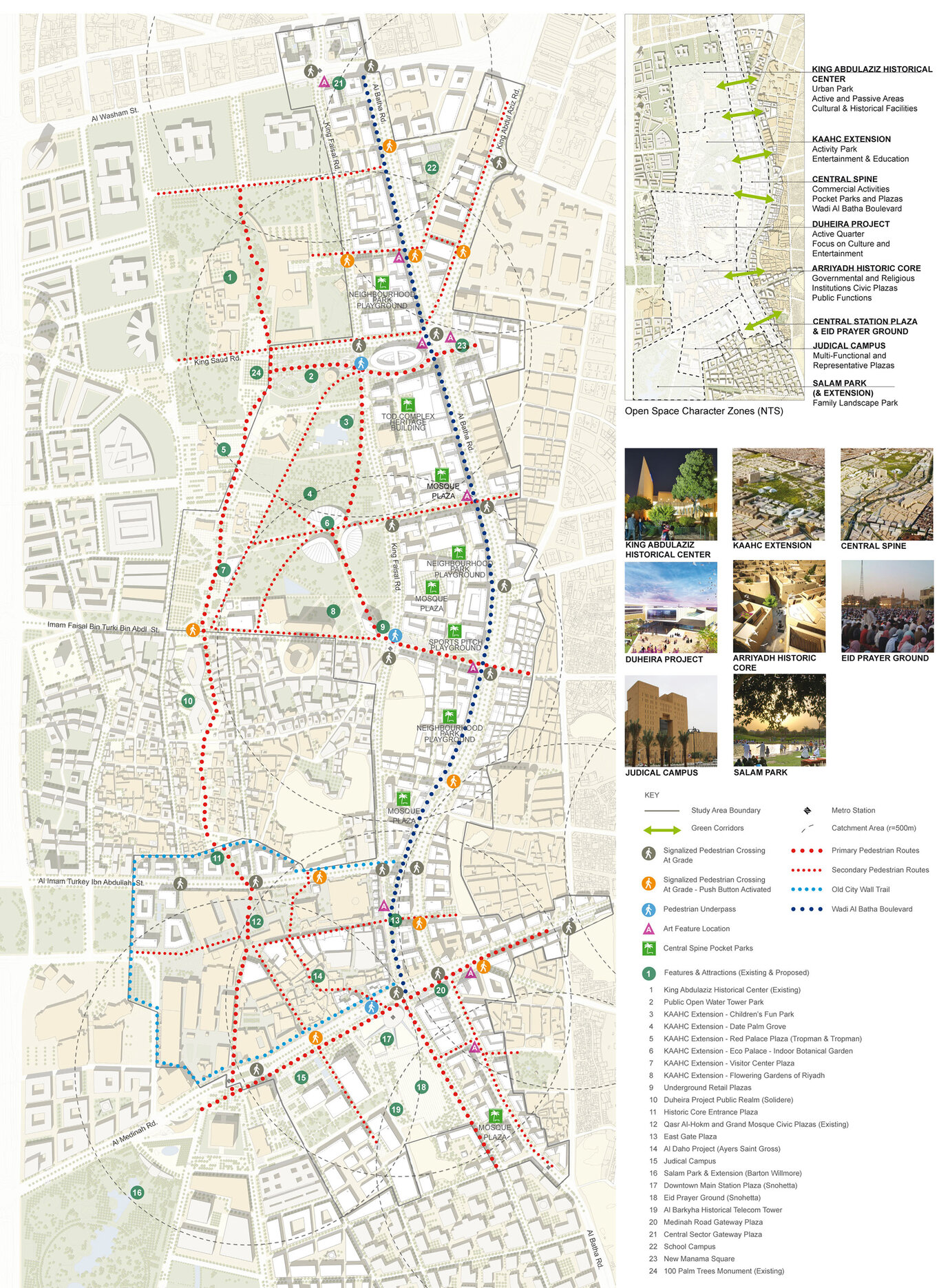
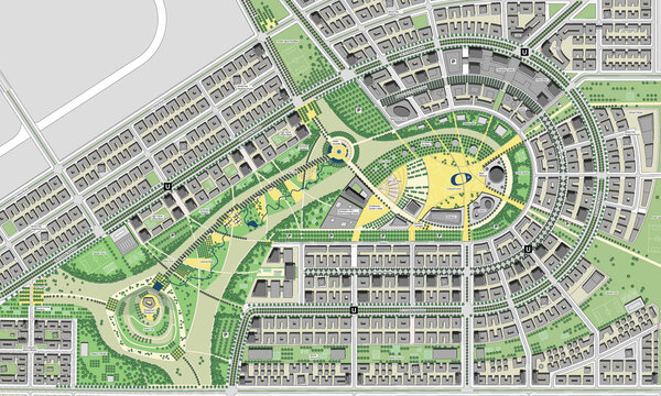
Planned open space concept with a view of the proposed pedestrian network and the location of the planned park with special attractions
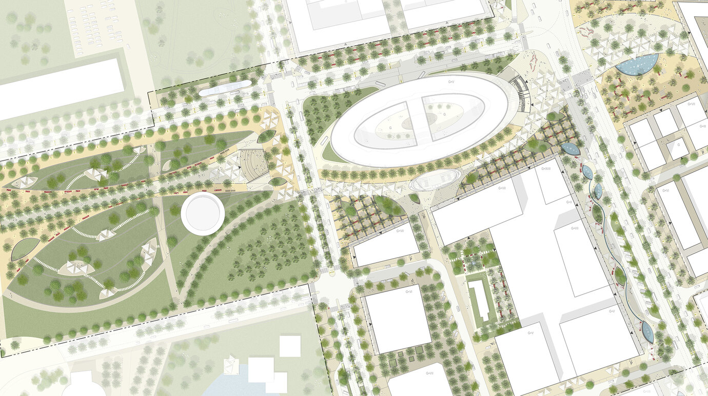
Detail of the hollow around the new METRO station and bus terminal with detailed representation of how the open space has been designed
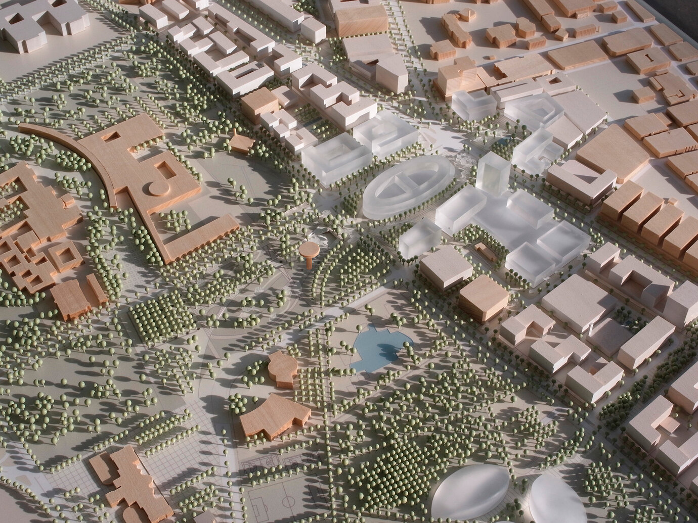
Photograph of the urban development model with a view of the landscaping at the King Abdualziz Historical Center
