Open space planning Dahiyat Al Asfar
Al-Ahsa, 2016 - 2018
Development of an open-space concept for the urban extension of Hofuf located at the Al Ahsa oasis with a focus on sustainable water management and integration of the ecologically important Al-Asfar Lake.
Use
Landscape Architecture
Timeframe
2016 - 2018
Client
SAUDCONSULT Riyadh

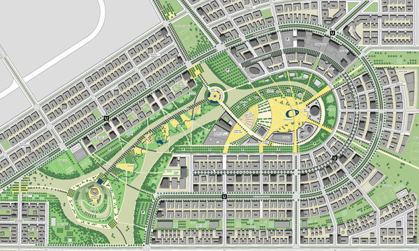
Concept for Dahiyat Al Asfar master plan
The Al-Ahsa region with its largest city Al Hofuf is located between Riyadh and Dammam. The region is favoured on account of its strategic position on the trade route between Riyadh and the neighbouring states of Qatar, Bahrain and the United Arab Emirates. The main driving factor for the city is its direct proximity to the world’s largest conventional oilfield.
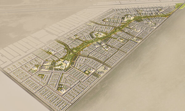
In line with the urban planning system, the city will develop to the east. In this area the Ministry of Housing manages a site that is roughly 200m m2 large and suitable for urban expansion. This land forms the eastern periphery of the Hoful region. The aim of the Dahiyat Al Asfar master plan is the development of a vision and a blueprint for a pioneering, sustainable and urban development in Saudi Arabia.

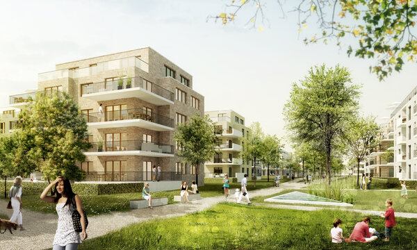
Illustration of the open-space concept in the area of the interface housing area / central green axis.
The project and the immediate neighbourhood are characterized by a large number of striking regional features. First and foremost is the Al-Asfar Lake that is fed mainly by surplus irrigation from the date farms and has evolved into an efficient ecosystem that is home to a large number of fauna and flora. Also characteristic of the region and important for it functionally is the world’s largest date palm oasis west of the project area.

Design detail in the central green axis with tram stop, pedestrian and cycle system and drainage canal.
At the center of the open-space concept is a green network with a central park axis that connects the project area with the city Hofuf and the lake. This axis not only has a recreational purpose and provides car-free mobility but is also the key element of the integrated rainwater management concept and serves the retention and diversion of rainwater into the Al-Asfar Lake.

Sketch of neighborhood green corridor with central mosque square, park and integrated cycle and pedestrian network.

Open-space concept diagram

Integrated rainwater management with the help of blue-green infrastructure.

Different canal typologies for the long-term diversion of excess irrigation water from the adjoining date farms and the surface drainage system.

Al-Asfar Lake

View across the date farms of the Al Ahsa Oasis